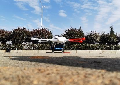
5mm@50m high precision 4.4 kg LiDAR mobile mapping system PM-1500
with 1500m long range and 2million points/s frequency
PM-1500 LiDAR mobile mapping system is a high-precision, high
frequency and long-range mobile laser measurement system
independently developed by Wuhan Hi-Cloud Technology Co., Ltd. It
integrates high-precision inertial navigation module and aerial
survey camera. The core component of the system is the laser
scanner with multi-echo technology function. It can synchronously
obtain 3D laser point cloud and POS data, quickly generate DSM, DEM
and DOM and produce DLG and 3D models through a complete set of
data processing and application software.
PM-1500 system can be applied to multi rotor UAV, VTOL fixed wing
UAV, small aircraft and helicopter to obtain dense high-precision
laser point cloud data on the ground on a fast flying mobile
platform.Combined with professional post-processing software, an
integrated solution will be offered. It is widely used in new basic
surveying and mapping, digital 3D modeling, topographic surveying
and mapping, cadastral survey, traffic survey, power line
inspection, forestry survey, disaster monitoring and other fields.
Main features of PM-1500 LiDAR mobile mapping system
- Long measurement range: maximun range 1500m@60% reflectivity
- High frequency: up to 2 million points/s
- High precision: range accuracy 5mm@50m; system accuracy better than
5cm
- Multi echo: 4 times echo
- Lightweight: 4.4kg
- Intregration: highly integrates sensors such as laser scanner, GPS,
IMU and aerial survey camera, etc.
- Cost-effective: stable performance, cost-effective
Main parameters of PM-1500 LiDAR mobile mapping system
1. Laser scanner
| Wave Band | Near Infrared (Class 1 ) |
| PRR | 100-2000Khz |
| Maximum Measurement Range | 1000m@20% reflectivity |
| 1500m@60% reflectivity |
| Range Accuracy | 5mm@50m |
| Angular Resolution | 0.001° |
| Scan Speed | 40-400 scans/s |
| FoV | 75° |
2. Camera system
| Camera Resolution | 42.4MP |
| Focal Length | 28mm |
3. POS system
| Position Accuracy(post-processing) | Horizontal 0.01m |
| Elevation 0.02m |
| Orientation Accuracy(post-processing) | Heading 0.009° |
| Pitch/Roll 0.005° |
4. System performance
| Dimension | 293×165×164mm |
| Absolute Accuracy | horizontal <5cm |
| vertical <5cm |
| Weight | 4.4kg |
Multi Echo | 4 times |
| Temperature and Humidity | Operation: -40℃~60℃, Humidity 85% |
| Storage: -45℃~70℃, Humidity 85% |
Application projects of PM-1500 LiDAR mobile mapping system
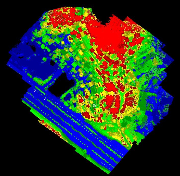
1. Topographic survey project
The survey area is mainly flat terrain with small undulations and a
maximum height difference of 20 meters. There is a main road in the
survey area, with more vegetation and several densely populated
areas.
Accuracy requirement: The point density requirement is better than
16pt/m²; Horizontal/vertical accuracy requirements: ≤5cm, meet
1:500 topographic surveying and mapping requirement


2. Inspection of 500kV DC transmission line project
The inspected line of the project is 500kV DC transmission line
segment, including 3 base towers and 2 intervals, with a total
length of about 0.8km.
Requirements: Danger point status analysis/Danger point predictive
analysis/Component status quantitative analysis


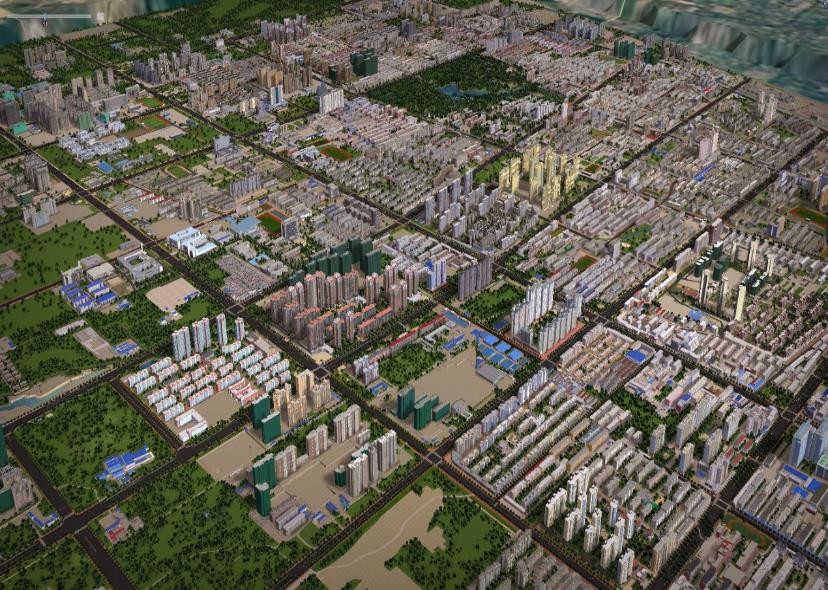
3. 3D city model project
The total area of the survey area is about 10 square kilometers. It
is necessary to obtain the original laser point cloud and oblique
image in the survey area, and generate the 3D model according to
the obtained original data.
The laser point cloud obtained by airborne LiDAR aerial survey
technology and the digital image data taken by oblique camera are
used to generate Digital Elevation Model (DEM) and Digital
Orthophoto Map (DOM) and produce terrain model. At the same time,
the 3D model is generated based on laser point cloud data and line
drawing. Obtain the building height through the 3D model, obtain
the building information through the oblique image and ground
photos, and then build the building information database.