Sign In | Join Free | My himfr.com
Home > UAV Mapping System >

4.5kg Multi Platform topographic UAV Mapping System ARS-1000L UAV Aerial Survey

    Buy cheap 4.5kg Multi Platform topographic UAV Mapping System ARS-1000L UAV Aerial Survey from wholesalers
     
    Buy cheap 4.5kg Multi Platform topographic UAV Mapping System ARS-1000L UAV Aerial Survey from wholesalers
    • Buy cheap 4.5kg Multi Platform topographic UAV Mapping System ARS-1000L UAV Aerial Survey from wholesalers
    • Buy cheap 4.5kg Multi Platform topographic UAV Mapping System ARS-1000L UAV Aerial Survey from wholesalers
    • Buy cheap 4.5kg Multi Platform topographic UAV Mapping System ARS-1000L UAV Aerial Survey from wholesalers

    4.5kg Multi Platform topographic UAV Mapping System ARS-1000L UAV Aerial Survey

    Ask Lasest Price
    Brand Name : Hi-Cloud
    Model Number : ARS-1000L UAV Mapping System
    Certification : ISO, others upon the requests
    Price : Negotiable
    Payment Terms : T/T
    Supply Ability : 10 sets/month
    Delivery Time : 10 working days
    • Product Details
    • Company Profile

    4.5kg Multi Platform topographic UAV Mapping System ARS-1000L UAV Aerial Survey

    High safety 4.5kg range 1350m@60% multi platform UAV Mapping System ARS-1000L with 15mm@150m accuracy


    Base on Riegl LiDAR, the UAV Mapping System ARS-1000L is developed and built by Hi-Cloud. It is a highly integrated system with modules of high-precision laser, high-definition camera, GPS, MEMS inertial navigation and storage control unit. With the advantages of strong performance, light volume, convenient installation and simple operation, it has been recognized by the majority of users and widely used in emergency mapping, topographic mapping, power line inspection, highway survey, coastal reef survey, excavation and filling volume calculation, archaeological survey and mapping and other fields.


    Specifications of UAV Mapping System ARS-1000L


    1. System performance

    IndicatorParameter
    Absolute Accuracy

    horizontal <5cm

    vertical <5cm

    Weight4.5kg
    Storage1TB SSD
    Input Voltage20~30V
    Power Consumption<75W
    Operation Temperature

    -10℃~+40℃

    Storage Environment-20℃~+50℃
    Humidity < 85%
    Laser ClassClass1
    (eye safe)
    2. Laser scanner

    Indicator

    Parameter

    Maximum Measurement Range1350m @60%
    Minimum Measurement Range5m
    Range Accuracy

    15mm @150m

    Repetition Accuracy10mm @150m
    Max. Effective Point Frequency750000 points/s
    Laser Gear for Adjustment6 levels
    Maximum number of received echoes

    4~15

    FoV(selectable)

    0~330°
    60°~90°airborne mode
    Scan Frequency(selectable)10~200 scans/s
    Angular Resolution0.001°
    3. POS system

    Indicator

    Parameter

    Position Accuracy(post-processing)Horizontal 0.01m
    Elevation 0.02m
    Orientation Accuracy(post-processing)Heading 0.010°
    Pitch/Roll 0.005°
    4. Camera system
    IndicatorParameter
    Camera Resolution≥42.4MP
    Camera Weight<500g
    Features of UAV Mapping System ARS-1000L
    1. The system integrates the 3D laser scanner, POS module and fan into the hardware architecture, which not only enhances the overall performance and stability of the system, but also compresses the volume to the extreme, and the overall weight is less than 4.5kg.
    2. The small volume and weight of the system enable it to be well carried on various carrier platforms. It is not only suitable for mainstream multi rotor UAV and VTOL fixed wing UAV, but also can be mounted on vehicle and backpack platforms for operation. Whether in airborne, vehicle or backpack mode, the system is equipped with corresponding installation firmware to meet the rapid installation and deployment on the operation site.
    3. The whole system adopts the fast sliding structure design, and there is no gap between the rack and the system, which ensures the stability and reliability of the equipment. There is no need for screws during installation, which improves the on-site deployment time. In addition, the system also provides a proprietary lightweight anti-collision protective sleeve to provide certain physical protection for the equipment and reduce unnecessary damage to the equipment in some harsh environments and emergencies. Further more, the loss prevention module is optional. After the UAV is lost, the equipment position can also be found to facilitate the search of equipment.
    4. The maximum range of LiDAR system is 1350m, and the system can operate normally even in the environment with large terrain drop. Long range measurement can also improve the acquisition efficiency of the equipment and collect more point cloud data in the same time.
    5. The laser emission frequency of the system is 750000 points per second. A higher point frequency means that it can better reflect the landform in the survey area and obtain more fine point cloud data. In addition, high frequency LiDAR equipment can be equipped with UAV with faster cruising speed. In the same time, more data can be obtained, which improves the data acquisition efficiency.
    6. The absolute accuracy of the system is better than 5cm, which meets the needs of most application scenarios. Under the measuring range of 150m, the ranging accuracy is better than 15mm.

    Practical application project of UAV Mapping System ARS-1000L


    Wind farm survey in mountain area
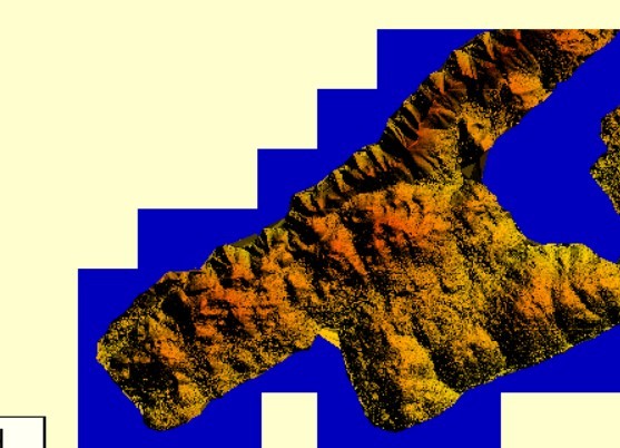

    Overview

    The survey area is mainly mountainous terrain. The average elevation in the wind farm survey area is high, and the altitude drop in some areas of the measurement area is over 300 meters. The whole wind farm covers an area of about 12 square kilometers. The vegetation is subtropical evergreen broad-leaved forest, with large vegetation coverage rate and various types.


    Difficulties

    The terrain of the survey area is complex, the altitude difference is large, the traffic is inconvenient, the climate environment is bad. There are several wind turbines with a height of more than 100 meters in the survey area, so it is difficult to design the route. The line of sight is blocked seriously, and it is difficult to locate the take-off point.


    Solution

    The project adopts ARS-1000L airborne laser measurement system. Three takeoff and landing points are selected in the whole survey area for a total of seven sorties.


    4.5kg Multi Platform topographic UAV Mapping System ARS-1000L UAV Aerial Survey

    4.5kg Multi Platform topographic UAV Mapping System ARS-1000L UAV Aerial Survey

    4.5kg Multi Platform topographic UAV Mapping System ARS-1000L UAV Aerial Survey4.5kg Multi Platform topographic UAV Mapping System ARS-1000L UAV Aerial Survey

    Quality 4.5kg Multi Platform topographic UAV Mapping System ARS-1000L UAV Aerial Survey for sale
    Inquiry Cart 0
    Send your message to this supplier
     
    *From:
    *To: Wuhan Hi-Cloud Technology Co.,Ltd
    *Subject:
    *Message:
    Characters Remaining: (0/3000)